
Wild Gooseberry Explorations Ltd.
Dedicated to bringing new life to forgotten and/or under-explored mineral deposits.
Primary Contact: Franklin Newhart franklinnewhart@hotmail.com

Discovery Story
During the mid 20th century of Canadian mining exploration, tough men spent winters in the bush, in rough camps, and day after day - walking their grids. Carrying the primitive sensors of the time, they followed their compass lines and waited ... waited ... waited for the signal -
MINERAL DEPOSIT BELOW!
Near the Little Shabumeni River, a team finally got that signal! Here is his discovery story:
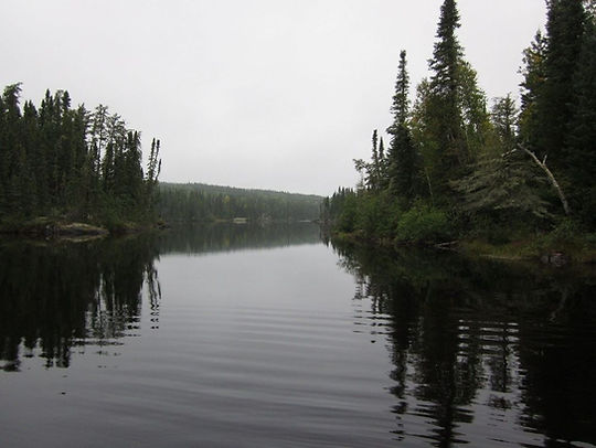
Little Shabumeni River, Ontario
Image: Fish Canada
Bob Durnin writes:
The project is a group of claims (cells in ON terminology) in the Little Shabumeni Lake area approximately 50-60 miles east of Red Lake, Ontario. If you draw a straight line east of Red Lake and a line straight north of Dryden, they should intersect in or near the general area in question. This band of Greenstone-type metamorphics, between Round Lake (perhaps 30 miles west) and Birch Lake (another 15 or so to the east), is known unofficially as the 'Golden Highway'. Over the years it has hosted more than one gold mine, including the Jackson/Manion and the Confederation (AKA Tom Bigbee). More recently, in the 70’s, Selco’s Uchi Lake Mine operated successfully for 10 years or so, mining copper. This was within 14 miles of my project.
In 1969 I was the NW Ont geophysical foreman for a major Canadian mining firm. Selco had announced development of their South Bay Zn, Cu, Ag mine, kicking off a staking rush. My company responded by flying a fixed-wing airborne survey from South Bay northward along that portion of the Con Trend. At the same time they had picked up a 200 claim option near North Spirit Lake, so with up to 20 men of various disciplines roaming around, I had a busy yet enjoyable summer.
In early September with season’s end near and manpower drifting away, I myself took two young lads in to check the last of our anomalies – an orphan on the north western fringe of the airborne survey. We flew in by Beaver and threw up a quick fly camp. We had no radio and had told the air service to give us three good-weather work days with a return flight in the pm of day four. This schedule would give us time to do a competent preliminary ground survey while enabling us to skedaddle before Sept weather locked us in.
The 20-claim block had been staked, cut and chained by Jean Alix of Val D’Or, the go-to people of the day. The line spacing was 400’ with 100’ stations, giving us 20 line-miles to survey.
We used a Crone JEM (Junior Electro-Magnetic) and a McPhar MF-1 fluxgate magnetometer. The JEM was a battery powered, dual-frequency transceiver unit. Used in-line (shoot back), with a coil separation of 200’, it gave us 100’ of depth penetration, considered adequate for a primary survey. As an added feature (unknown and unused by less experienced operators) the JEM could easily be reconfigured to vertical-loop mode – an excellent tool for field interpretation. The McPhar fluxgate was one of the preferred magnetometers of that era.
We had done the usual air recon before setting up camp so I knew we would have no difficult topography to deal with. It was my usual habit to start all field surveys at the furthest point from camp. Thus, if we had a couple of miles to do before our return flight came in, we could complete the survey in early am.
We did the survey in loops with myself as lead hand always on the south. The mag man, a new hire that spring, was proving to be a “keeper” but I still kept him close at hand to monitor his readings, in case some detail was indicated. Day one proved to be uneventful – our readings were as flat as the ground we walked on. The area was treed with mature poplar and jackpine with scant underbrush. We saw no outcrop nor float.
Day two started out likewise – flat, flat. Near noon, coming up what I call line 8E (see Figure 1). I picked up an indication. It was only 3 dip-angle degrees but I was always aware of my surroundings. Topo can give you hints and we were at the tip of what appeared to be an open area to our west. Coming down line 4E we found the open area to be a dry swamp – hardly a depression but within its boundary there were NO trees – only sparse clumps of willows. At the swamp’s southern perimeter we picked up a medium strength conductor with associated mag activity.
Coming up line Zero we hit the swamp at its west end and we were now virtually in the center of our 1969 claim block. Here the conductor was quite strong with a low-to-high frequency ratio of 60%. We also had a medium strength flanking mag high indicating a southerly dip.
We continued northward along the western fringe of the swamp which had ended with a berm of perhaps two feet. To our right were small pools of water and to our left was a fringe of cedars – the only cedar trees we had come across. My EM readings became out-of-phase (noisy) and I had difficulty pinning down a null point. Magnetics were also erratic but after 300 – 400’ the swamp boundary curved eastward and our readings told us that we were leaving the conductive zone.
We reviewed our field notes and it was obvious that we had been following rather than intersecting the conductor. We returned to the south side of the swamp and I switched the JEM to vertical loop mode. With my partner transmitting, I read a series of short E/W lines all at 50’coil spacing. As I had suspected, the conductor followed the curve of the swamp, folding back eastward. I also proved that the conductor was at a depth of less than 25’ at the fold. The magnetic picture also cleared up, but without proper grid control it was pointless to record the readings.
However, before we moved on, we ran two short compass and pace shoot-back lines – one at 2E and one at 2W. 2E confirmed the fold and 2W confirmed that the zone did NOT extend westward. I would have liked to cut and chain a small detail grid but we lacked the tools and the time. We still had ten line-miles to do and a date with warm beds and hot running water in Red Lake. The rest of the grid replicated the east half – no action.
In Red Lake I tuned up my field maps and wrote a report recommending a small detail grid and a priority one drill target.
My superiors demurred with the decision coming from Toronto. “Too expensive!” and even now, many years later, I do not understand why. However – in those days we had a reputation of doing excellent field work with piss-poor drill follow-up.
A reader of this may think the foregoing has been unnecessarily descriptive, however there is a point to this process: In 1969 I was in year ten, geophysically speaking. I had covered the Shield from Contwoyto Lake NWT to Chibougamau PQ, including almost every greenstone belt in Ontario. I had been part of detailed surveys of two future producers but:
Never, ever, had I seen anything as interesting
as that folding conductor in a treeless oasis
in the center of a broad expanse of glacial till.
Current Claim Details
54 cells: 3,400 acres
-
Red Lake Mining Division: on the Confederation Trend: 30 mi. E of Red Lake: 60 mi. N of Ear Falls
-
Access by all-weather, all-season logging road passing through our claim block - unrestricted public usage
-
High-voltage transmission line near at hand within five miles
-
Clearcut circa 2015, no commercial timber remains within our claim boundaries
-
No running water within our claim boundaries – ecologically benign
-
Aboriginal Consultations done with due diligence, excellent rapport maintained - Full report is available - contact Franklin Newhart
-
Secure land tenure

Figure 1 - Field Sketch 1969

Figure 2 - Location Geography

Figure 3 - Claim Blocks


VTEM Survey Conclusions & Recommendations (Geotech)
Between July 2nd and July 7th, 2021, a helicopter-borne versatile time domain electromagnetic (VTEM™plus) horizontal magnetic gradiometer geophysical survey was completed over the Red Lake Project near Red Lake, ON, on behalf of Wild Gooseberry Exploration Ltd.
The total area coverage was 6 km2 and the total survey line coverage was 71 line-kilometres over a single block. The principal sensors included a Time Domain EM system, and a horizontal magnetic gradiometer system with two cesium magnetometers. Results have been presented as stacked profiles, and contour colour images at a scale of 1:5,000. A formal interpretation is not included in this study, but RDI resistivity-depth imaging has been performed in support of the VTEM data.
Based on the geophysical results obtained, a number of magnetic anomalies have been identified across the survey area, however no late channel/bedrock conductors of significance. Magnetically, the Red Lake block is host to a grouping of small to medium sized (>300-500m wide), variably oriented, circular to elongate-shaped magnetic anomalies, ranging up to ~600 nT, that are concentrated in the north-central portions of the block. Lower magnetic intensities are found in the southern part. Magnetic derivatives highlight mainly ENE-WSW geologic trends and more minor discordant NW-SE structural fabric. Electromagnetically, the Red Lake property appears to be generally resistive, with only a few weak early-channel/near surface conductivity, including an ENE linear feature in the northwest corner of the block that correlates with the river channel. Late channel EM responses are very weak and barely above noise-threshold levels and show poor line-to-line correlation. EM decay time constants (Tau) show peak values in the 0.2 msec range, which is consistent with low conductivities.
RDI imaging indicate that apparent resistivities as high as 4000- 4500 ohm-m and weak lows in the 50-150 ohm-m range. RDI sections and depth-slices suggest that the bedrock consists of a fairly uniformly resistive upper layer (>1-5k ohm-m) that is approximately 300-400 m thick that overlies a variably, weakly conductive (<100-500 ohm-m) basement. Maximum depths of investigation (DOI) extend to >600m.
The Red Lake region is known to be prospective for Archean, shear-hosted, orogenic gold mineralization. It is likely that both EM and magnetic response will be of interest for exploration targeting. Due to the lack of mid-to-late channel EM anomalies, EM anomaly picking and related Maxwell plate modeling are not recommended. However, more advanced 1D layered earth modeling of the EM data may prove useful in highlighting anomalous resistive and conductive zones of interest, related to alteration, particularly in the near-surface, both in plan and in cross-section. Magnetic CET structural lineament analysis and 3D MVI magnetic inversions will be useful for mapping structure, alteration, and lithology in 2D-3D space across the property.
We recommend that more advanced, integrated interpretation be performed on these geophysical data and these results further evaluated against the known geology for future targeting.
Full VTEM Report available on request
Prospector Analysis - Geotech VTEM Air Survey
The air survey sheds new light on our project. While some of my 1969 conclusions are still valid, new info can give us a deeper understanding of what may lie below. I no longer see the possibility of massive sulfides - the EM component of the air survey precludes that possibility. What we may have is heat-related alterations within the pluton. These alterations can result in pipe-like columns containing disseminated mineralization derived from the granodioritic country rock. Our VTEM magnetics show numerous indications of concentric high mag activity with some connecting trends which can be interpreted as shearing. Additional mineralization will occur within these shear zones.
The Geotech written report virtually dismisses the EM results, citing: "no line-to-line correlation and lack of continuity". This fits my theory - conductive continuity would not be expected in disseminated mineralization.
You will note that the written report is gold-centric, a trap which has caught many conventional thinkers for up to 100 years. Red Lake is gold and they tend to ignore the South Bay Cu, Zn, Ag and other historic base metals sniffs throughout the Con Trend. Yet I myself am unwilling to take gold off the table. These individual magnetic concentrations could in fact be amphibolites. I could draw a comparison to the Echo Bay / Lupin at Contwoyto Lake. There, the amphibolites, high in iron content, held little gold but up to 6 oz / ton were in the interconnecting shear zones. (Let us not forget that Madsen / Pure Gold is in amphibolites).
Diamonds: Can we really ignore them? Kimberlite plugs can be vertical or flat-lying. Mineralization can surround these plugs thus perhaps explaining my 1969 semi circle conductor.
Nickel: One of my trap line advisors has suggested that we may have the dreaded barren phyrhotites, but I have had past experience with barren phyrhotites. Geophysically they are an amorphous blob and associated conductivity is more centralized. But, if the heat related alterations produced phyrhotites, they can also carry nickel at the outer contact wall. Thus, looking at my 1969 peripheral conductor, I can see this as non-disseminated nickel.
I see this claim block as a series of layers, the first being overburden - depth generally unknown. Then we have the Mainprize batholith, depth also unknown but we can assume that the batholith is becoming thinner as it nears our eastern boundary.
We cannot discount the possibility of a third layer of mafics & ultramafics. The report cites a relatively resistive upper layer, approx. 300-400 m thick. This would be within the pluton. They also state a max depth pen of 600 m which poses a conundrum. Are the magnetics entirely within the pluton or are we seeing a combination of the underlying third strata?
I wish we had a prehistoric fly on the wall to tell us the tale. All the ingredients were tossed into a huge bowl and baked at max heat. Only a properly designed exploration program will solve the fruit cocktail - I anticipate a high ratio of cherries. Am I right? Only the corebarrel will be the judge.
Impact of glaciation on the South East quadrant of the Mainprize Batholith
(A layman’s theory)
References:
- Geomap P3295
- Wild Gooseberry web site Figures 1 and 4
- Nicola Mining, Merritt BC: New Craigmont
- Historical Argosy Mine
- Nemiscau - Northern PQ
The Little Shabumeni River is a fault line - quite dramatic in its width and length. Why did this fault occur? It does not separate rock types - both sides are mapped as the eastern part of the Mainprize Batholith, a secondary granodiorite intrusion. Topography alone can solve this mystery.
The north side of the river shows no evidence of glaciation but the south side is flat with no outcrops. The soil is a mixture of sand, gravel and clay evenly treed with a mixture of broad leafs and conifers. The geomap gives us a hint- the detritus shows a definite strike of southwest by west - the direction the glacier traveled as it slowly melted.
The immense weight of the glacier caused the river/fault and the heat created by this cataclysmic event resulted in the concentric mag highs (Fig 4). The Mainprize is becoming thin and thus probably overlaps mafics and ultra-mafics beneath. I have reason to believe that these mafics joined with the heat related alterations to form porphoryritic shear zones. These skarns can be seen in Figure 4 and are similar to the structure at Nicola's New Craigmont project.
The historic Argosy mine (16 K northwest) derives precious metals from similar shear zones.
The Nemiscau area on the east side of James Bay is a broad expanse being worked by numerous juniors and mid range entities. I have no clear understanding of the general geology but porphoryritic skarns are generally the source of poly-metallics.
Summation: You will note that most of my references are remote properties - very expensive to get at dollar wise. Wild Gooseberry is readily accessible giving you more bang for your exploration buck.
Bob Durnin President and CEO
Wild Gooseberry Explorations Ltd.
Float
An ex-urban myth
This was researched during the summer of 1969 at a local fountain of knowledge AKA the bar at the Red Lake Inn. I was told the tale by at least three old timers, later confirmed by a respected geologist.
Down-strike from our claim block, towards Round Lake there exists an area containing "float" - surface rocks sitting on glaciation detritus. Since the early days these rocks have been poked, prodded and analyzed. Assays consistently show economic ore grades of precious and/or base metals, yet the host rock types seem to have no correlation with any known outcrop up-strike.
Accurate data on how far float has traveled is impossible to establish but it is generally accepted that round, evenly polished rocks have come from afar. This float still has rough angular edges. Could Wild G be the source? Where they deposited here as the glacier finally melted, feeding the rivers and lakes of the Confederation Trend? Go figure.
Bob Durnin President & CEO
Wild Gooseberry Explorations Ltd.
Prospector Remarks and Recommendations
In no particular order
-
With no water or commercial timber within our boundaries, building access roads will be merely pushing deadfall aside.
-
A few short traverses using a Crone Radem or Geonics EM-16 will pinpoint the folding conductor. We saw no boulders in 1969, therefore driving casing to bedrock should be trouble-free. This is a potential preliminary target for a Winkie drill.
-
An alternate exists: a backhoe will easily day-light the bedrock. Eminently economical, this will have the added benefit of allowing one to screen for diamond indicators and/or gold grains.
-
With promising results from early exploration, an expanded program will follow.
-
Our VTEM magnetics are open both easterly and to the south west. At some point a new airborne survey would be advisable.
-
A conventional vertical loop or max-min ground survey would be a waste of time and resources. Induced Potential will fill in the details.
-
The river appears to be a dead zone. I see it as a fault line but is it also a contact separating different blends of the country rock within the batholith? The topography on the north side is a dramatical change compared to our claim block with outcrop ridges that appear to have escaped glaciation.
All parameters show that our property can be worked
more economically than others in our section of the Con Trend.
Other projects active in the Con Trend may extoll themselves as “grassroots”.
Only Wild Gooseberry is truly GRASSROOTS.